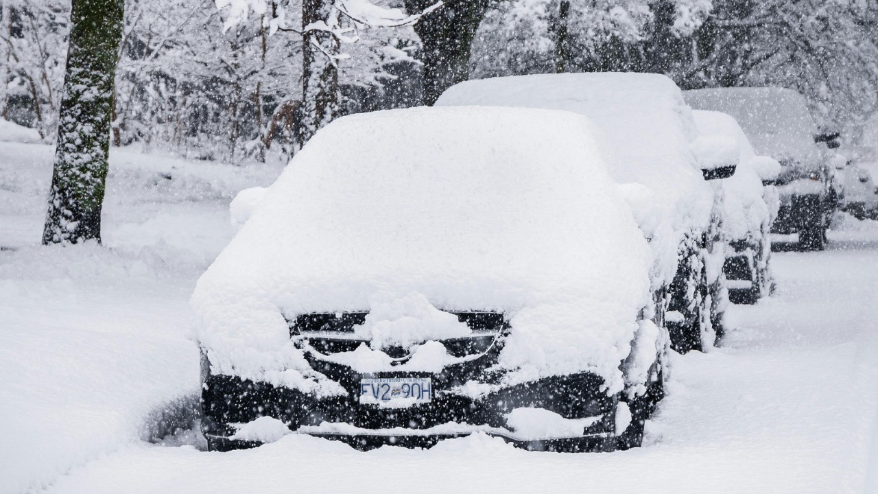
Rare winter system expected to bring snow and possible severe weather across multiple regions
A sprawling winter system is lining up to hit the United States with a rare mix of heavy snow, coastal flooding risk and pockets of severe thunderstorms. Forecasts point to a storm track that could spread impacts from the Midwest to the East Coast, arriving on the heels of an already punishing season of Arctic outbreaks and disruptive coastal lows. The setup raises the prospect that some communities will move directly from tornado cleanups and springlike instability back into deep winter conditions.
Meteorologists say the pattern reflects a volatile atmosphere that has already produced a January and February defined by sharp temperature swings and high-impact storms. With fresh winter storm watches, wind advisories and cold weather alerts stretching from Indiana to Southeast Pa and Yosemite Valley, residents across multiple regions are being urged to prepare for rapidly changing conditions and the possibility of both snow and severe weather in a short window of time.
Storm setup: a volatile atmosphere over a cold foundation

The looming winter system is forming over a continent that has been repeatedly chilled by Arctic air since early January, which helps explain why forecasters expect snow to develop quickly once moisture arrives. Earlier this year, a prolonged cold outbreak sent subfreezing air deep into the southern United States and even as far south as Belize, leaving a deep reservoir of chill near the surface. That kind of entrenched cold means that even modest precipitation can fall as snow, and heavier bands are more likely to accumulate efficiently on roads and power lines.
At the same time, ocean temperatures along the Atlantic coast remain relatively mild, feeding energy into developing low pressure systems that ride up the shoreline. Climate scientists tracking global patterns note that La Ni is weakening, which can make the jet stream more prone to sharp north south swings that favor strong winter storms. The combination of cold land, relatively warm water and an energetic jet stream is the same recipe that has already produced several high impact systems this season and is now setting the stage for another.
Midwest: from tornado warnings to snow and wind
In the Midwest, the atmosphere has already shown how quickly it can flip from severe thunderstorms to wintry conditions. After a line of strong storms swept across Indiana, forecasters shifted quickly to highlight a Wind Adviso and a fresh chance for snow or mixed precipitation later in the week. That pivot captures the essence of this pattern, with warm sector storms followed by a sharp frontal passage that drags temperatures down and allows wraparound snow to develop behind the departing low.
One of the most striking examples of this whiplash came near Bloomington, where the NWS is examining damage to determine whether a tornado touched down on the west side of the city. That investigation, described under the banner of WEATHER with the blunt question Did a tornado hit Bloomington, underscores that residents are not only bracing for snow but also recovering from severe weather that struck just hours earlier. As the new storm pushes colder air back into the region, the same communities that heard sirens for rotating storms may soon be dealing with slick roads and blowing snow.
Great Lakes and Ohio Valley: wind advisories and quick hitting snow
Farther north and east, forecasters are warning that strong winds will be a defining feature of this system as it sweeps across the Great Lakes and Ohio Valley. A regional First Alert Forecast titled Dropping temps & getting windy then snow highlights how quickly conditions will deteriorate once the cold front passes. Meteorologist By Liz Braden notes temperatures falling through the 30s, with a specific mention of readings near 38, as gusty winds pick up ahead of accumulating snow later in the day.
Along with the snow, local stations are flagging Closings and Delays and advising viewers to Dismiss Closings Alerts Bar only after checking for updated travel information, while a regional Wind Advisory signals the potential for downed limbs and spotty power outages. In this corridor, the storm may not produce blockbuster totals, but the combination of a quick burst of snow, temperatures dropping below freezing and strong gusts could still create hazardous driving, particularly on east west routes that are more exposed to crosswinds.
Mid Atlantic: coastal storm risk and snow probabilities
Along the Mid Atlantic coast, forecasters are watching for a new low pressure center to form and track near the shoreline, a setup that often brings a sharp gradient between heavy snow inland and mixed precipitation or rain near the water. A briefing from regional offices notes that the probability of at least light snow accumulations of 2 inches or more has climbed into the 60 to 80% range for some interior zones. That same document flags the potential for Minor to moderate coastal flooding at high tide as onshore winds pile water against the shoreline.
The pattern is familiar to residents of the Carolinas and Virginia, who earlier this month dealt with a rapidly strengthening coastal system that delivered heavy snow and Arctic air to the Mid Atlantic. That earlier storm, documented as a rapidly intensifying coastal storm, showed how quickly conditions can deteriorate when a low tracks just offshore, with snow bands pivoting inland and Arctic air surging south behind the center. With another similar setup now on the table, coastal communities are watching tide forecasts as closely as snowfall maps.
Northeast corridor: nor’easter potential and high stakes for travel
In the Northeast, attention is locked on whether the developing coastal low will consolidate into a full fledged nor’easter that hugs the coastline and taps Atlantic moisture. Forecast model guidance remains split, and one detailed Analysis notes that it is T 48 hours before a potential blockbuster event for the Northeast, with scenarios ranging from a glancing blow to a high impact snowstorm. The spread reflects uncertainty in the exact track and speed of the low, which will determine how far inland heavy snow bands can extend and how long they linger over major population centers.
Farther south, a winter storm watch is already in effect for Southeast Pa for Sunday and Monday, with forecasters warning that gusts may reach 35 mph as the system intensifies. That alert, flagged as Published in local briefings, highlights the risk of blowing snow and reduced visibility along key corridors if the storm takes the more impactful track. With millions of people living along the East Coast from Washington to Boston, even modest shifts in the storm path could mean the difference between a manageable plowable event and a disruptive nor’easter that snarls air and road travel.
New York City and I 95: winter storm warnings and coastal flooding risk
New York City and the surrounding suburbs sit near the heart of the uncertainty zone, where relatively small changes in storm track can flip the forecast from slushy mix to heavy, wet snow. A regional update shared that National Weather Service has issued a winter storm warning for the five boroughs of NYC, as well as Nassau and western Suffolk counties, beginning in the evening and continuing into the following day. That alert, posted in Feb, signals confidence that at least several inches of snow are likely, with the potential for higher totals if the coastal low deepens more quickly.
Along the broader Interstate 95 corridor, forecasters describe rising Chances of an impactful Noreaster, with plowable snow increasingly possible for cities from Philadelphia to Boston. Live storm trackers emphasize that the exact placement of the heaviest snow band will control where the worst travel disruptions occur, but they also stress that even areas on the fringe could see enough accumulation to cause spinouts, flight delays and localized power issues if heavy, wet snow clings to trees and lines.
West and mountains: cold advisories and avalanche reminders
While attention focuses on the eastern half of the country, the western mountains are dealing with their own set of winter hazards tied to this broader pattern. In Yosemite Valley, the National Weather Service issued a cold weather advisory that began On Friday at 9:38 a.m. and extends until Saturday Feb 21 in the morning, warning that temperatures could drop to 10 degrees. The advisory urges visitors to wear layers, a hat and gloves, a reminder that even when skies are clear, bitter cold can pose a threat to hikers, campers and anyone caught outside without proper gear.
Elsewhere in the West, heavy snow has already contributed to dangerous avalanche conditions, including a recent incident in which Six skiers were rescued and nine went missing near Lake Tahoe, California. That report, referenced in a Post that also mentioned a Wednesday storm, illustrates how deep snowpacks and shifting weather can rapidly destabilize slopes. Even as the new system targets the central and eastern states, mountain communities are being reminded to check avalanche forecasts and treat backcountry terrain with caution.
Recent analogs: lessons from earlier winter storms
The atmosphere has already offered a preview of what a strong coastal winter storm can do this season. At the end of January, a pronounced low pressure area just off North Carolina generated widespread snow and gusty winds across parts of the Southeast and Mid Atlantic, with official summaries documenting how quickly conditions deteriorated as the center passed. That event, chronicled in a detailed winter storm overview, showed that even areas unaccustomed to frequent snow can see significant disruption when a coastal low tracks just offshore.
More broadly, the ongoing January February cold across North America has highlighted how a southward displaced polar vortex can sustain repeated cold shots over the same regions. That persistent chill has helped set the stage for snowier outcomes whenever moisture laden systems move in, and it suggests that the coming storm is part of a larger seasonal pattern rather than an isolated anomaly. For planners and emergency managers, those analogs reinforce the need to think beyond a single event and prepare for the possibility of multiple high impact storms in quick succession.
Preparation, communication and what comes next
As the new winter system organizes, forecasters are urging residents across the affected regions to pay close attention to updated alerts and timing forecasts. National guidance warns that some mountain areas could still see up to 8 feet of snow, 7 inches of rain and winds near 60 mph in separate events this season, reflecting the kind of extremes highlighted in Rightnow, long range outlooks. Those numbers, paired with the current storm’s potential, underline why transportation departments, school districts and utilities are already reviewing contingency plans and staging equipment.
Communication will be critical as the system evolves, especially where snow, wind and severe thunderstorms may overlap in time or space. Live coverage has already highlighted that Millions are already on alert as a brewing nor’easter threatens snow and coastal flooding along the Northeast seaboard. With additional heavy snow warnings calling for up to 13 inches and urging travelers to delay all nonessential trips, the next several days will test how well communities can pivot between hazards, from tornado damage in Bloomington to icy roads in Southeast Pa and bitter cold in Yosemite Valley.

Leo’s been tracking game and tuning gear since he could stand upright. He’s sharp, driven, and knows how to keep things running when conditions turn.