
Prospects Rise for a Powerful El Niño by Summer, With Significant Potential Effects on Florida’s Weather Patterns
The signs point to a shift in the tropical Pacific that could reshape weather across much of the globe, including right here in Florida. Forecasters at NOAA and other climate centers note that the region has moved out of the recent La Niña phase into neutral territory, with sea surface temperatures beginning to climb. Models now place the odds of El Niño emerging between late spring and summer at around 60 percent or higher, and many suggest it could strengthen considerably by fall or winter.
You watch these patterns because they influence everything from daily rain chances to the intensity of the upcoming hurricane season. A developing El Niño warms waters in the central and eastern equatorial Pacific, which alters atmospheric circulation on a massive scale. That change often ripples into the Atlantic basin and across the southern United States, setting the stage for noticeable differences in temperature, rainfall, and storm activity.
What El Niño Actually Means
El Niño develops when trade winds weaken and allow warmer water to pool across a broad stretch of the Pacific. This warming disrupts the normal east-west temperature gradient and triggers shifts in the jet stream and subtropical high-pressure systems. Scientists track it through sea surface temperature anomalies in key regions like the Niño-3.4 area.
The current transition comes after a weak La Niña faded earlier this year. Subsurface heat content in the Pacific has been building, supported by recent westerly wind bursts. If the pattern holds, you could see El Niño conditions taking shape by June through August, with a decent chance it persists and possibly intensifies through the end of 2026.
Rising Odds for a Strong Event
Climate models have steadily raised the probability of El Niño forming this summer. The latest NOAA outlook puts the chance near 62 percent for June-August, while some ensembles from Columbia University’s IRI suggest even higher confidence in the transition. A subset of forecasts hints at the possibility of a strong or even very strong event by late 2026, though uncertainty remains about exact strength.
You see this kind of buildup in the data from buoys, satellites, and ocean models. Westerly winds have already started to push warmer water eastward. If those conditions continue, the event could rival some of the more notable ones in recent decades. Still, forecasters emphasize that outcomes range from moderate to potentially very strong, depending on how the atmosphere responds over the next few months.
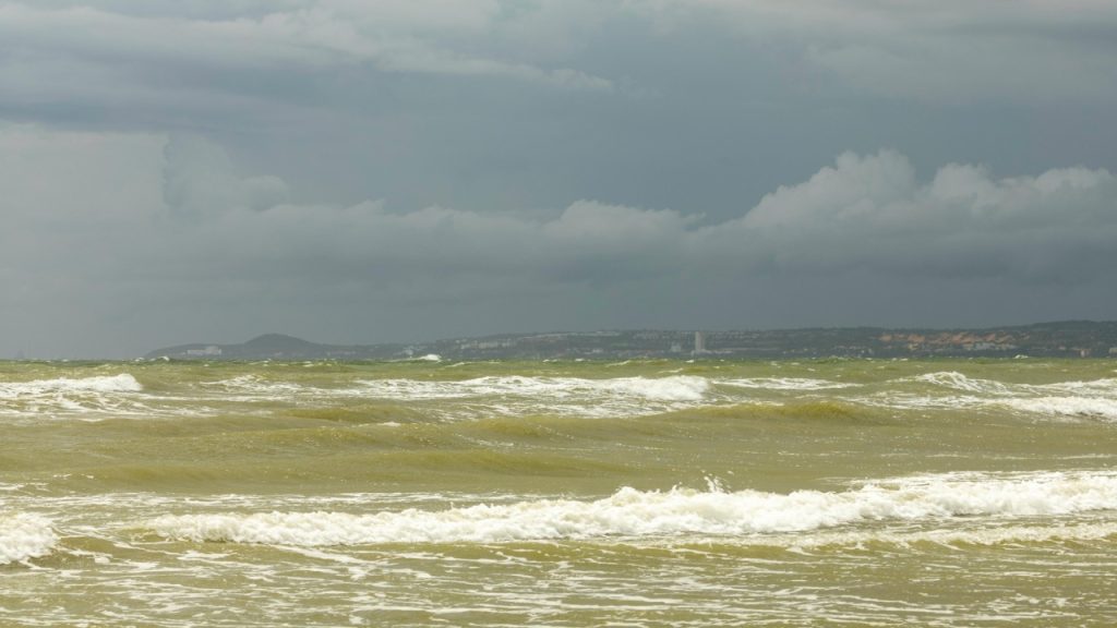
Impacts on Florida’s Hurricane Season
In the Atlantic, El Niño tends to ramp up vertical wind shear, which tears apart developing tropical systems before they can organize. That often translates to fewer named storms and a lower chance of major hurricanes reaching the Gulf or Florida coast during peak season. Historical patterns show suppressed activity in many El Niño years.
You still need to prepare as always. Warm Atlantic waters can provide fuel for any storms that do form, and a single landfalling system can bring serious impacts regardless of the overall count. Experts note that El Niño offers no guarantee of a quiet season, especially with ocean temperatures running high in recent years. The shear tends to increase later in the season, so early storms could still pose threats.
Changes to Rainfall and Severe Weather
Florida often sees shifts in precipitation when El Niño takes hold, particularly as the pattern strengthens into fall and winter. The southern jet stream becomes more active, steering storm systems across the Gulf Coast and increasing the odds of heavier rainfall in many parts of the state. This can help ease drought concerns but also raises the risk of flooding.
You might notice more frequent periods of unsettled weather, including the potential for severe thunderstorms. Central and southern Florida have historically experienced heightened severe weather threats during El Niño winters, driven by stronger storm tracks and increased moisture. Summer and early fall could bring mixed signals, with some areas seeing enhanced rainfall from Pacific moisture sources.
Temperature Patterns You Can Expect
Summer temperatures across Florida may not shift dramatically under a developing El Niño, but the broader circulation changes can influence heat distribution. As the event matures into fall and winter, the southern United States often trends cooler and wetter than average due to the repositioned jet stream. Northern parts of the country tend to see milder conditions.
Pay attention to how these large-scale shifts interact with local factors like soil moisture and urban heat. In Florida, any increase in cloud cover and rain from an active southern storm track could temper daytime highs at times. Long-range outlooks suggest the influence grows stronger later in the year, so monitor updates as the pattern evolves.
Preparing for a Variable Year Ahead
Your daily and seasonal decisions benefit from staying informed on these outlooks. Farmers, water managers, and emergency planners in Florida track El Niño signals closely because they affect crop yields, reservoir levels, and wildfire risk. Wetter winters can reduce fire danger but demand vigilance against flooding.
You gain an edge by combining these climate signals with shorter-term forecasts. Check resources from NOAA’s Climate Prediction Center and local National Weather Service offices for the latest guidance. Even with the probabilities tilting toward El Niño, weather always carries variability, so keep your plans flexible and your preparations current.
Looking Beyond the Current Forecast
Scientists continue to refine understanding of how El Niño interacts with other climate drivers, including longer-term warming trends. The Pacific pattern does not operate in isolation, and its strength will determine how clearly the typical signals appear in Florida. Early indications suggest this could become a meaningful event, but monitoring through summer remains essential.
You see the value in these seasonal outlooks because they help frame expectations without promising certainty. As sea surface temperatures evolve and new model runs come in, the picture will sharpen. In the meantime, treat this as one piece of the puzzle that influences Florida’s weather in the months ahead.

Asher was raised in the woods and on the water, and it shows. He’s logged more hours behind a rifle and under a heavy pack than most men twice his age.