Climate Projections Highlight Flood Risks for Major U.S. Coastal Metropolises by Mid-Century
Scientists tracking ocean levels and coastal conditions have watched the data accumulate for years. Projections now point to noticeable changes by the middle of this century, with sea levels along U.S. coastlines expected to rise by about 10 to 12 inches on average. That shift, combined with more intense storms and land subsidence in certain areas, will push floodwaters farther inland during both routine high tides and major events. You live in or near one of these places, or you know people who do, and the implications touch infrastructure, homes, and daily routines in ways that demand attention now.
Understanding the Scale of Rising Waters
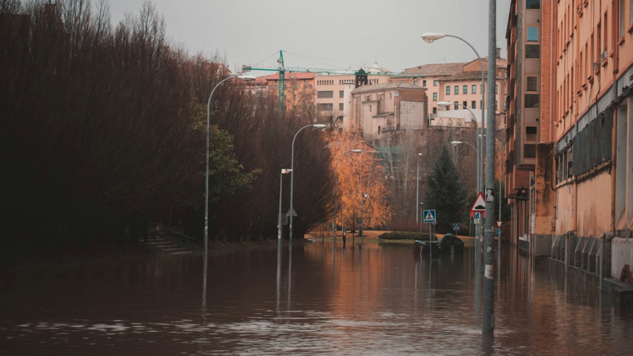
Models from federal agencies show consistent upward trends driven by warming oceans and melting ice. Along the East and Gulf coasts, the increase hits harder in many spots because the land itself is settling. This relative change means water reaches streets and buildings more easily than it once did. You see the difference in places where sunny-day flooding already appears during certain tides.
By mid-century, moderate flooding events that disrupt traffic and damage property could happen ten times more often in some locations. Planners use these numbers to evaluate everything from subway systems to neighborhood drainage. The data leaves little room for doubt about the direction things are heading if emissions patterns hold steady.
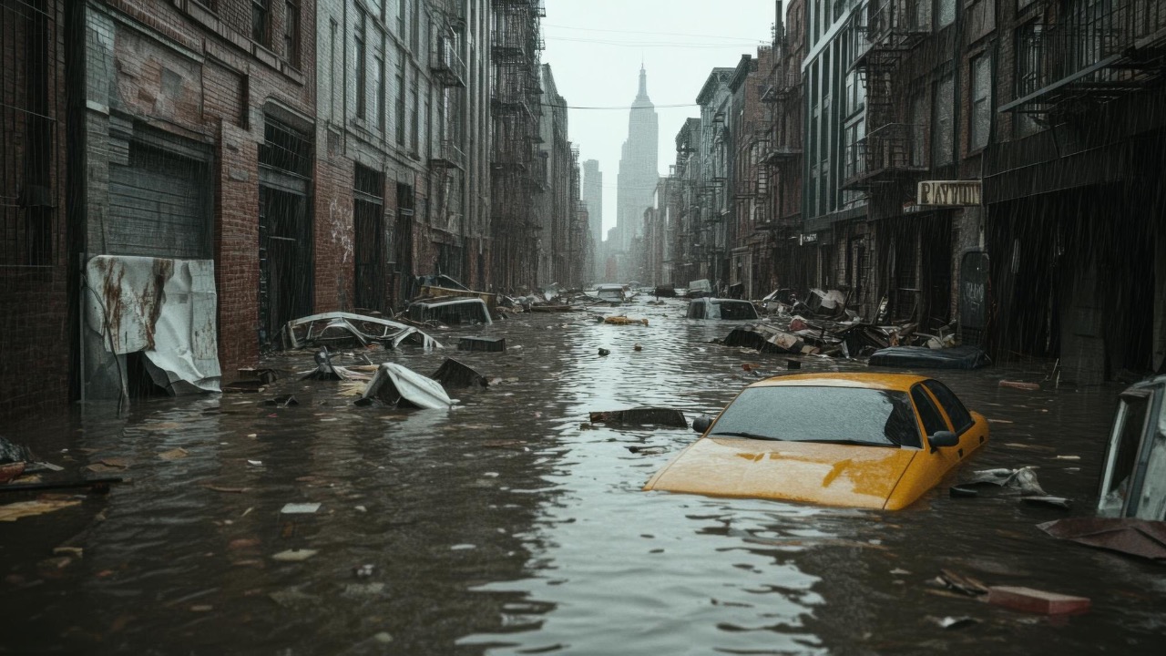
New York Faces Growing Exposure
Your view of the New York skyline might look unchanged for now, but projections tell a different story for low-lying neighborhoods. An estimated 271,000 residents live in zones where a severe coastal flood becomes more likely by 2050. Areas in Brooklyn, Queens, and parts of Manhattan sit close enough to the water that extra inches make a measurable difference during storms.
The city has already experienced notable surges in recent years. As water levels climb, those events reach new blocks and affect more infrastructure. Officials track these risks while weighing upgrades to barriers and pumps, but the pace of change tests existing systems built for different conditions.
Florida Stands Out in Population at Risk
When you drive through South Florida, the flat terrain and proximity to the ocean become obvious. Statewide estimates put more than 500,000 people in areas vulnerable to a 100-year flood by mid-century. Miami and surrounding communities top the list because porous limestone allows water to push up from below as well as over the surface.
Local governments have poured resources into pumps and raised roads, yet the combination of sea level rise and heavy rains keeps pressure high. You notice the difference in neighborhoods where flooding now happens more regularly, even without a named storm. Adaptation efforts continue, but the numbers show why urgency remains.
Gulf Coast Cities Deal With Extra Pressures
Head down to the Gulf and you encounter cities like New Orleans and Houston where subsidence adds to the challenge. Land sinking combines with rising water to expand flood zones faster than global averages suggest. Projections indicate hundreds of thousands of residents could see increased exposure in the coming decades.
Hurricane history in the region already demonstrates how storm surges amplify risks. With higher baseline water levels, the same size storm delivers deeper flooding over larger areas. Communities invest in levees and restoration projects, yet maintaining pace with the projections requires sustained focus and funding.
West Coast Encounters Its Own Vulnerabilities
San Francisco and other California spots face different dynamics, with less dramatic sea level rise in some models but still meaningful local impacts. Low-lying ports, airports, and neighborhoods sit in the path of changing conditions. You might not think of the Pacific coast the same way as the East, but data shows clear reasons for planning.
Earthquake concerns and infrastructure age layer on top of flood projections. Cities evaluate how to protect valuable waterfront assets while preparing for more frequent high-tide events. The conversation mirrors patterns seen elsewhere, adjusted for regional geology and development patterns.
How Daily Life Could Shift
Imagine commuting routes that flood more often or neighborhoods where insurance costs climb. By 2050, the frequency of disruptive high-tide flooding rises sharply in many coastal metros. Schools, hospitals, and power stations appear on risk maps that local leaders consult when updating emergency plans.
You feel these changes through higher utility bills, rerouted traffic, or decisions about where to buy property. The data encourages earlier action on drainage upgrades and building codes. Many residents already adjust routines around tide charts in vulnerable spots.
Adaptation Efforts Underway Across Regions
Coastal cities have started elevating critical facilities and restoring wetlands that absorb surge energy. New York has barrier studies, Miami experiments with injection wells, and Gulf communities reinforce levees. These steps buy time, yet experts emphasize that long-term success depends on matching the pace of environmental change.
Federal and state programs supply mapping tools and funding streams that help municipalities prioritize. You see progress in raised roads or improved stormwater systems in pilot areas. The work continues as new projections refine the picture year by year.
What This Means for Decisions Ahead
Property values, public budgets, and relocation conversations all enter the discussion when flood maps expand. Homeowners review elevation requirements while businesses assess supply chain exposure. Planners stress the value of factoring these risks into every major project from now forward.
You weigh personal choices against the broader trends. Staying informed through local updates and supporting practical infrastructure investments helps communities manage the transition. The projections offer a window to act while options remain broader than they will be later.

Asher was raised in the woods and on the water, and it shows. He’s logged more hours behind a rifle and under a heavy pack than most men twice his age.