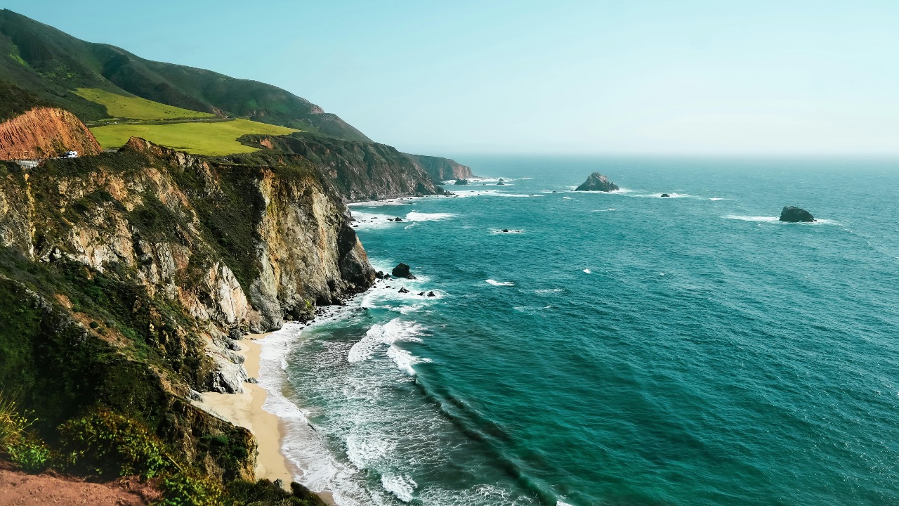
Strong El Niño event expected to bring unusual conditions to California coast
Forecasters are warning that a strong El Niño in the Pacific could reshape weather along the California coast in the coming months, bringing warmer ocean waters, heavier storms and unusual surf. The developing pattern is already altering sea temperatures and atmospheric circulation, setting up a season in which familiar coastal rhythms may give way to volatile swings between soaking rain and stubborn heat.
Scientists caution that no two El Niño events behave exactly the same, yet the current signals suggest a powerful episode that could rival some of the most disruptive in recent history. For communities from San Diego to Crescent City, that means preparing for a broad spectrum of hazards, from coastal flooding and erosion to wildfire and public health risks.
What happened
Climate scientists tracking conditions in the equatorial Pacific report that sea surface temperatures are running well above average, a hallmark of a strong El Niño pattern. In the central and eastern Pacific, those anomalies are large enough that some researchers have started using the term “super El Niño” to describe the emerging event, a label previously reserved for only the most intense episodes such as 1997 to 1998 and 2015 to 2016. Early analyses cited by California meteorologists indicate that temperature departures in key monitoring regions are already approaching thresholds associated with those historic events.
As the Pacific warms, the usual west-to-east circulation in the tropics weakens and shifts, which in turn tugs the jet stream south toward California. That realignment often funnels a parade of winter storms into the state, a pattern that can be especially pronounced along the coast where incoming systems first make landfall. Recent outlooks describe a scenario in which the jet stream becomes both stronger and more persistent over the eastern Pacific, a configuration that has previously produced prolonged wet periods for coastal counties.
Regional experts quoted in new analyses of the developing pattern say California is staring at the possibility of a “monster” El Niño, with particular concern about how that would affect already stressed shorelines. According to one detailed assessment of potential impacts on the state, a very strong event could combine high tides, storm surge and large waves to accelerate erosion along vulnerable stretches of the California coast. That same analysis notes that bluff failures and damage to oceanfront infrastructure tend to spike during powerful El Niño winters.
The altered Pacific pattern is also expected to influence tropical cyclone behavior. Warmer waters in parts of the eastern Pacific can fuel stronger hurricanes that track farther north and west than usual. A recent overview of El Niño’s broader weather footprint highlighted the risk that more intense eastern Pacific hurricanes could send remnant moisture into California, raising the odds of off-season heavy rain and rare tropical storm impacts on coastal communities. That perspective, drawn from global climate experts, frames the current El Niño as a key driver of unusual climate extremes in multiple regions at once.
Closer to home, forecasters who focus on the Southwest have started to outline specific scenarios for California. One recent regional breakdown pointed to the potential for above average winter precipitation, a greater number of strong Pacific storms and a heightened threat of flooding in low-lying coastal areas. The same regional outlook also flagged the possibility that warmer ocean temperatures could boost late season tropical activity that steers moisture toward Southern California, echoing the rare landfall of Tropical Storm Hilary that drenched the region in a previous warm-water year. Analysts in that report framed the current El Niño as a likely driver of “supercharged” weather for the state and the broader Southwest region.
Why it matters
A strong El Niño can be a mixed blessing for California, especially along the coast where communities sit at the intersection of ocean and atmosphere. A wetter winter can help refill reservoirs, recharge groundwater and ease drought conditions that have strained water supplies from San Diego to the Bay Area. Yet concentrated bursts of heavy rain increase the risk of flash flooding, mudslides and debris flows, particularly below burn scars left by recent wildfires in coastal ranges.
For coastal infrastructure, the stakes are especially high. When El Niño raises sea levels by several inches through a process known as coastal “El Niño” sea height anomalies, even routine storms can push water into streets, parking lots and low-lying neighborhoods. Combined with king tides and large swells, that temporary boost in sea level can overwhelm seawalls, damage piers and undercut bluffs that support homes, roads and rail lines. Past strong El Niño winters have produced dramatic scenes of collapsed stairways in Pacifica, flooded boardwalks in Santa Cruz and battered piers in Southern California, and local officials are already reviewing those case studies as they plan for the months ahead.
Beach erosion is another major concern. When powerful winter waves ride on top of elevated sea levels, they can strip sand from beaches faster than it can be naturally replenished. That not only threatens homes and businesses that rely on a protective buffer of sand, it also narrows the space available for recreation and wildlife. For example, nesting habitat for the western snowy plover and haul-out sites for harbor seals can shrink during intense erosion seasons, with ripple effects for coastal ecosystems that are already stressed by warming oceans and rising baseline sea levels.
Marine conditions themselves are likely to shift in ways that matter for fisheries and tourism. Warm El Niño waters tend to suppress the upwelling of cold, nutrient-rich water that normally feeds the base of the coastal food web. When that nutrient conveyor belt slows, plankton productivity can drop, which then affects anchovies, sardines and the larger predators that feed on them, including salmon and sea lions. Past strong events have been linked to unusual wildlife behavior along the California coast, such as sea lion strandings and changes in whale migration patterns, as animals follow shifting pockets of food.
Public safety agencies also pay close attention to how El Niño reshapes surf and storm patterns. Larger, more frequent swells can create dangerous conditions for swimmers, surfers and boaters, especially when paired with strong rip currents and rapidly changing weather. Harbor masters may need to contend with stronger surge that strains moorings, while coastal highways could face more frequent closures due to rockfalls and flooding. Emergency managers in counties like Santa Barbara, Ventura and Orange are already revisiting evacuation plans and sandbag distribution strategies that were tested during previous El Niño winters.
Economic impacts can cut both ways. A stormy season may boost business for ski resorts in the Sierra Nevada and for contractors involved in flood control and coastal reinforcement projects. At the same time, repeated storm damage can strain local budgets, disrupt tourism and increase insurance costs for oceanfront properties. For small businesses that depend on steady coastal visitation, such as surf shops, restaurants and kayak rental outfits, the balance between dramatic, surf-driven crowds and storm-driven cancellations can be delicate.
What to watch next
In the near term, scientists will watch a handful of key indicators to gauge how intense this El Niño will become and how directly it will affect California. Sea surface temperatures in the Niño 3.4 region of the equatorial Pacific, which climate agencies use as a primary benchmark, will signal whether the event is strengthening into the top tier historically associated with the most disruptive winters. Atmospheric patterns such as the Southern Oscillation Index and the position of the Pacific jet stream will help forecasters refine storm track expectations for the West Coast.
Residents along the California coast should pay attention to updated seasonal outlooks from federal and state agencies as summer transitions into fall. Those outlooks will translate global signals into more specific projections for rainfall, temperature and storm frequency in different parts of the state. Local offices of the National Weather Service typically issue detailed briefings that highlight which communities face the highest risk of flooding, coastal erosion or strong surf, and those products will become more targeted as the event evolves.
Leo’s been tracking game and tuning gear since he could stand upright. He’s sharp, driven, and knows how to keep things running when conditions turn.