The 15 Ugliest States in America, Ranked by the Data
Beauty rankings are rarely kind, and when they are built from data instead of opinion, they can sting even more. A recent attempt to quantify which parts of the United States are the least visually appealing uses hard numbers on things like protected land, pollution, and urban sprawl to identify the 15 “ugliest” states. The list focuses on scenery and environmental stress, not on people, and it highlights how development choices, geography, and policy combine to shape what residents and visitors see every day.
Viewed through that data-driven lens, and supplemented by related rankings that flag weak quality of life and low scenic scores, the picture that emerges is less about shaming and more about tradeoffs. States that score poorly on natural beauty often carry heavy industrial legacies, dense infrastructure, or flat, heavily farmed terrain. Some are simply small, crowded, or overshadowed by neighbors. Here is how the 15 states stack up, from relatively rough around the edges to the one that tops the “ugly” scorecard.
How the “ugly score” works
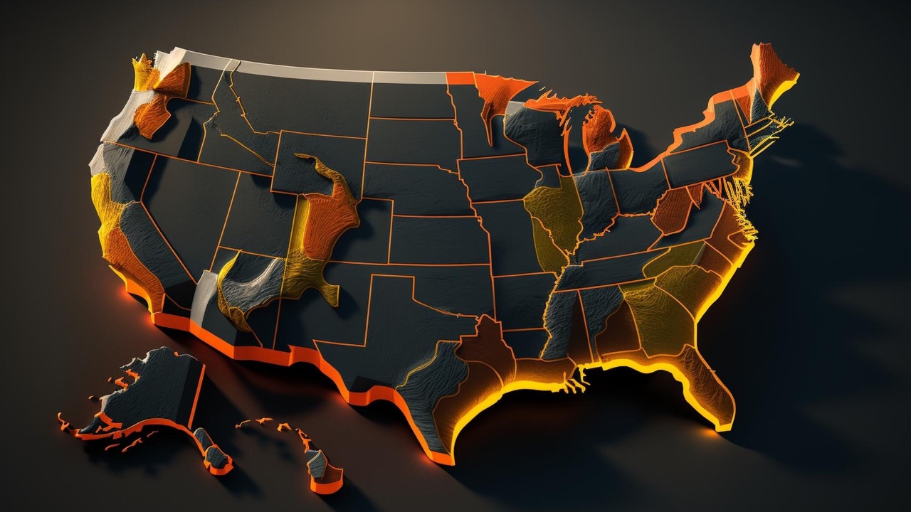
The ranking that identifies the 15 least attractive states relies on what it calls an “Ugly Score,” a composite that weighs factors such as the share of protected land, the amount of coastline or dramatic topography, and the intensity of human alteration. At the top of that list is an “Ugly Score: 99.07,” a figure that signals the state judged to have the most compromised scenery among its peers. The methodology is not about architecture or cultural life, only about how much of the original environment remains and how visually striking it is.
The analysis behind the list draws on national datasets that track things like park acreage, wetlands, and road density, then cross-references those with pollution and industrial activity. It functions more like an environmental index than a travel brochure. A separate set of rankings that identifies states with poor quality of life, such as those that highlight where “They are the states with America’s worst quality of life in 2025,” often overlaps with the places that fare badly on visual appeal. Both types of lists tend to penalize high pollution, limited access to green space, and heavy infrastructure.
Travel-focused rankings that label some states as the “least beautiful” add another thread. One such list singled out Kansas as the least beautiful state, a decision that sparked local debate but reflected a similar reliance on scenic variety, mountains, and coasts. Taken together, these sources create a consistent picture of which states struggle most when judged purely by their physical setting.
15. Texas: vast, busy, and heavily altered
Texas is enormous, and that scale cuts both ways. The state contains deserts, forests, barrier islands, and canyons, yet much of what most people experience sits within sprawling metro areas and industrial corridors. The long Gulf Coast is lined with refineries and shipping infrastructure, and many inland highways run through flat, scrubby terrain cut by power lines and pipelines. When an index tallies miles of coastline against how much of it is protected or scenic, the state’s working shoreline drags down the score.
Population growth and an energy-heavy economy have also reshaped large swaths of Texas. Extensive oil and gas development, wind farms on the plains, and large-scale agriculture leave relatively few stretches of untouched land near where most residents live. National datasets that track protected acreage show that only a small share of the state is preserved compared with its overall size, which weighs on any metric that rewards intact ecosystems. For travelers who stick to interstates between Houston, Dallas, San Antonio, and the Permian Basin, the visual impression is dominated by concrete, billboards, and industrial plants rather than natural drama.
14. Tennessee: scenic pockets, cluttered corridors
Tennessee has postcard-worthy areas in the Smokies and along the Cumberland Plateau, yet those pockets coexist with long commercial strips and heavily developed river valleys. The state’s central and western regions are crisscrossed by highways lined with warehouses, signage, and low-slung retail that blur together over hundreds of miles. When beauty rankings focus on the average view rather than the highlights, those long, built-up corridors count more than a weekend in the mountains.
The state also faces environmental stress along major waterways. Industrial and agricultural runoff into rivers and reservoirs affects water clarity and shoreline vegetation, which in turn influences how scenic those areas appear. Urban growth in Nashville and surrounding counties has brought rapid construction, clear-cut subdivisions, and widened roads. These trends show up in measures of impervious surface and habitat fragmentation, which push Tennessee down any index that rewards intact forest or wetland cover.
13. Oklahoma: quality of life and flat horizons
Oklahoma appears in national lists that single out “the states with America’s worst quality of life in 2025,” where metrics such as crime, health, and environmental conditions are combined. Those same conditions often correlate with how attractive a place looks. Industrial facilities near residential neighborhoods, visible oil infrastructure, and limited public green space in some cities contribute to a harsher visual environment.
Geographically, large parts of Oklahoma are relatively flat, with prairies and agricultural fields that stretch to the horizon. While that openness has its own appeal, it does not score highly in rankings that favor mountains, dramatic coastlines, or dense forests. Tornado damage and frequent rebuilding along key corridors also create a patchwork of newer construction, parking lots, and aging strip malls. For visitors driving through on interstates, the combination of flat terrain and utilitarian development can come across as monotonous rather than scenic.
12. Kansas: a lightning rod for “least beautiful” labels
Kansas has been singled out in travel-focused coverage as the least beautiful state in the country, a claim that drew on an earlier ranking and was amplified by local outlets. One report described how Kansas was ranked by a travel publication, prompting residents to defend their home. Another piece highlighted iconic spots such as the Tallgrass Prairie National Preserve and credited “Tallgrass Prairie National Preserve (KSNT/Michael K. Dakota)” as evidence that the state does have striking scenery in places.
Those defenses are fair, but they do not erase the broader pattern that drives Kansas into the bottom tier of beauty rankings. Much of the state is devoted to intensive agriculture, with large monoculture fields replacing native prairie. Tree cover is sparse across wide areas, and the road network forms a rigid grid that reinforces a sense of sameness. When an index looks at the share of land under protection or the variety of natural features, Kansas scores poorly compared with states that have mountains, coasts, or extensive forests. The result is a state that can be quietly beautiful up close, yet still lands near the bottom when judged from satellite data and highway views.
11. Kentucky: industry in the valleys, scars on the hills
Kentucky sits at the transition between the Midwest and Appalachia, and that geography shapes both its beauty and its blemishes. The eastern part of the state includes rugged hills that once held dense forest, but decades of coal mining have left visible scars on many slopes. Surface mines, valley fills, and associated roads appear clearly in national land cover datasets, which penalize heavy extraction activity.
In the central and western regions, industrial facilities and transportation hubs cluster along rivers and interstates. Warehouses, rail yards, and aging industrial plants line key corridors, creating long stretches of gray infrastructure. While horse farms and rolling bluegrass country are heavily promoted in tourism materials, those landscapes occupy a smaller share of the state than the marketing suggests. When a ranking weighs the total proportion of land that looks like postcard Kentucky against the areas dominated by mining, highways, and sprawl, the balance pulls the state into the “ugly” group.
10. Mississippi: low-lying, vulnerable, and heavily modified
Mississippi’s Gulf Coast and riverine wetlands should be natural assets, yet they also expose how vulnerable and heavily modified the state’s environment has become. Coastal areas have been reshaped by ports, casinos, and hurricane rebuilding, with long seawalls and highway strips that limit access to natural beaches. Inland, extensive logging and agriculture have fragmented forests and wetlands that once covered much of the state.
National environmental indicators often show Mississippi struggling with pollution and limited investment in public amenities. Many smaller towns feature aging commercial corridors and underfunded parks, which translates into fewer visually appealing public spaces. Combined with frequent flooding in low-lying areas and visible storm damage that can linger for years, the result is a state where the natural setting has been compromised in ways that show up clearly in satellite imagery and roadside views alike.
9. West Virginia: dramatic terrain, visible extraction
West Virginia might seem like an odd inclusion on an “ugly” list, given its dramatic mountains and forests. The problem is not a lack of topography but the extent of visible extraction. The state is synonymous with coal mining, and large-scale surface mines have reshaped ridgelines and valleys. Aerial surveys and land cover maps reveal extensive areas where mountaintops have been removed and replaced with terraced, unvegetated slopes that stand out starkly against surrounding forest.
In many communities, industrial structures occupy riverbanks and valley floors, crowding out public waterfronts. Aging infrastructure, from bridges to retaining walls, further detracts from the scenic potential of the terrain. While some former mines have been reclaimed, the process is uneven, and the sheer number of disturbed sites keeps West Virginia anchored in the lower half of beauty rankings that factor in human alteration and visible environmental damage.
8. South Carolina: rapid growth and coastal strain
South Carolina has barrier islands and historic towns that feature heavily in tourism campaigns, yet the state’s overall score is pulled down by rapid, often haphazard growth. Along major highways, especially between Columbia, Greenville, and the coast, long stretches of roadside development create a visual blur of billboards, chain stores, and subdivisions. These corridors dominate the daily experience for many residents, even if the postcards show live oaks and marshes.
Coastal regions face their own pressures. Marshlands and beaches have been squeezed by resort construction and second-home development, reducing the share of shoreline that remains in a natural state. Inland, clear-cutting for timber and new housing has fragmented forests, which shows up in national datasets that track habitat loss. When an index weighs the total area of intact coastal and forest ecosystems against the spread of pavement and rooftops, South Carolina’s scenic highlights cannot fully offset the clutter.
7. Alabama: industrial corridors and underprotected nature
Alabama occupies a biologically rich slice of the Southeast, yet much of that richness is hidden from casual view. The state’s most visible corridors, such as the routes between Birmingham, Montgomery, and Mobile, are lined with industrial plants, warehouses, and commercial strips. For travelers and many residents, those views form the mental picture of the state, and they are not flattering.
Environmental indicators often show Alabama grappling with pollution in rivers and coastal waters, especially in the Mobile Bay region. Ports, shipyards, and petrochemical facilities cluster along the waterfront, leaving relatively few stretches of undeveloped shoreline. Inland, a patchwork of timber plantations and agricultural fields has replaced large areas of native forest. When rankings focus on the percentage of land under strong protection and the visibility of industrial infrastructure, Alabama falls into the lower tier.
6. Virginia: beauty at the edges, sprawl in the middle
Virginia illustrates how a state can have celebrated scenic areas and still land on an “ugly” list when the average view is considered. The Blue Ridge and Shenandoah Valley are undeniably attractive, but the heavily populated corridor from Northern Virginia through Richmond to Hampton Roads is dominated by highways, subdivisions, and commercial zones. That corridor holds a large share of the state’s population, which means it weighs heavily in any index that looks at human alteration.
Coastal Virginia faces similar tradeoffs. Wetlands and estuaries have been filled or constrained by military bases, shipyards, and port facilities. While some protected areas remain, the overall share of natural shoreline is limited. Combined with aging industrial zones along rivers such as the James, the result is a state where the most visible and populated areas are far less scenic than the marketing images suggest. National datasets that track sprawl and impervious surface confirm that development pressure has eroded much of the state’s natural cover.
5. Illinois: flat fields and urban gray
Illinois is anchored by Chicago, a city with striking architecture but also extensive industrial zones, rail yards, and expressways that dominate the visual experience. The broader metropolitan area stretches across northern Illinois, with highways framed by warehouses, billboards, and dense housing. For any ranking that looks at the view from major roads, this urban gray weighs heavily.
Outside the metro region, much of Illinois consists of flat farmland. While some find beauty in orderly fields, the lack of topographic variety and limited forest cover count against the state in scenic metrics. Rivers such as the Illinois and Mississippi have long been harnessed for navigation and industry, with levees, locks, and industrial sites lining their banks. When an index tallies the proportion of land that remains in a natural state, Illinois scores poorly, which helps explain why it appears in the upper half of an “ugliest” list.
4. Georgia: booming growth, strained scenery
Georgia’s rapid population growth has brought intense development pressure, especially around Atlanta and along the I-75 and I-85 corridors. Subdivisions, logistics hubs, and retail centers spread across former forest and farmland, creating a nearly continuous band of sprawl. From the highway, long stretches of the state present as traffic, signage, and sound walls rather than mountains or marshes.
Coastal Georgia, including areas near Savannah and the Golden Isles, still contains significant natural beauty, but those areas are relatively small compared with the state’s overall footprint. Inland, clear-cutting and pine plantations have altered large sections of the landscape. National land cover data show fragmented habitats and expanding urban footprints, both of which depress scenic scores. The result is a state where the most visible and populous regions are among the most heavily altered, which pulls Georgia high on any “ugly” ranking.
3. Louisiana: working coast and environmental damage
Louisiana’s identity is tied to its wetlands and coast, yet that same coast has been carved up by canals, pipelines, and levees. Large portions of the shoreline are dominated by refineries, chemical plants, and port infrastructure that serve national energy and shipping networks. From the air and from the road, industrial structures and eroding marshes define much of the view.
The state also faces severe land loss as coastal wetlands subside and erode, a process accelerated by human modification of the Mississippi River and widespread canal cutting. Communities along the lower Mississippi and in the industrial corridor between Baton Rouge and New Orleans live with a dense concentration of plants and storage tanks, often referred to collectively as a “chemical corridor.” That concentration of heavy industry, combined with frequent storm damage and incomplete rebuilding, produces a visual environment that many scenic indices penalize heavily.
2. Ohio: industrial legacy and suburban sprawl
Ohio’s position near the top of the “ugly” list reflects both its industrial legacy and its modern development pattern. Major cities along Lake Erie and the Ohio River grew around manufacturing and shipping, leaving a ring of refineries, mills, and warehouses along key waterways. Even as some heavy industry has declined, the physical structures remain, and they dominate many waterfront views.
Inland, the state is covered by a dense network of suburbs and exurbs that spread along interstates such as I-71 and I-75. Commercial strips with big-box stores, gas stations, and signage stretch for miles, while older industrial towns feature aging infrastructure and limited green space. National indices that track protected land show that only a modest share of Ohio’s territory is preserved in parks or reserves, which lowers its score in any beauty-focused ranking. When the average view includes flat farmland, traffic, and smokestacks, the state inevitably lands near the top of an “ugliest” list.
1. Rhode Island: small, crowded, and heavily built
At the very top of the data-driven “ugly” ranking sits Rhode Island, with an “Ugly Score: 99.07.” That figure reflects a combination of small size, dense development, and extensive coastal modification. The state’s limited land area means that highways, suburbs, and industrial zones occupy a high proportion of the territory. Even scenic bays and inlets are often lined with marinas, seawalls, and closely packed housing, leaving relatively little untouched shoreline.
Rhode Island’s industrial history along Narragansett Bay and its role as a dense New England hub contribute to the score. Ports, shipyards, and older factories occupy waterfronts that might otherwise be parkland, and many urban neighborhoods have limited access to natural green space. When a national index compares the share of preserved open land and natural coastline to the total area, Rhode Island’s numbers are small, which is why it emerges as the state with the highest “ugly” score despite having pockets of undeniable charm.
Why these 15 states cluster together
Across the 15 states, several themes repeat. Many have flat or gently rolling terrain that lacks the dramatic relief of the Rockies or the Pacific Coast, which hurts them in rankings that reward mountains and cliffs. Others have extensive industrial corridors, especially along rivers and coasts, where refineries, ports, and chemical plants occupy large tracts of land. Heavy infrastructure, such as interstates, rail yards, and power plants, is more visible in these states than in those with larger protected areas that buffer development from public view.

Leo’s been tracking game and tuning gear since he could stand upright. He’s sharp, driven, and knows how to keep things running when conditions turn.