Severe Thunderstorm Warnings Issued as Large Hail and Tornadoes Threaten Central States
When severe weather lines up across the middle of the country, you can feel it before the first warning ever hits your phone. The air gets heavy, the wind can’t make up its mind, and the sky starts building in layers that don’t look right. This latest round of storms across the central states has all the hallmarks—strong instability, wind shear, and the kind of setup that produces big hail and fast-moving tornadoes.
You’re not dealing with one isolated storm either. This is a broad system pushing through, lighting up radar across multiple states. Here’s what you need to understand about what’s happening and how it plays out on the ground.
Conditions Are Lined Up for Severe Weather
You’re seeing a classic setup across the Plains and Midwest. Warm, moisture-rich air is pushing north while cooler, drier air drops in from the west. That clash creates instability, which is the fuel storms feed on.
Add in strong winds higher up in the atmosphere, and storms start to organize instead of falling apart. That’s when things turn serious. Instead of short-lived cells, you get long-tracking storms that can rotate. When everything lines up like this, it doesn’t take much for a storm to go from a thunderhead to something that produces hail, damaging winds, or a tornado.
Large Hail Is One of the Biggest Immediate Threats
Hail doesn’t get the same attention as tornadoes, but it does a lot of damage in a short time. In setups like this, you can see hailstones grow well beyond golf-ball size.
Those stones form when strong updrafts keep lifting rain back into freezing air, adding layers each time. When they finally fall, they hit hard. You’re looking at shattered windshields, dented trucks, and livestock caught out in the open. If you’re outside when it starts, there’s not much time to react. Getting under solid cover matters more than trying to outrun it.
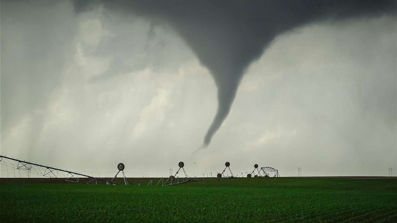
Tornado Potential Is Real, Not Just a Possibility
When forecasters mention tornadoes in this kind of setup, you take it seriously. The wind patterns in place allow storms to rotate, which is how tornadoes form.
You might not see one in every storm, but it only takes a single cell to produce a dangerous situation. Some of these can form quickly with little warning, especially in fast-moving systems. Visibility can also be poor if rain wraps around the circulation. That makes it harder to spot and easier to underestimate until it’s too close.
Storms Are Moving Fast Across Multiple States
This isn’t a slow-moving system that sits in one place all day. These storms are covering ground, which means warnings can change quickly depending on where you are.
You might start the afternoon under clear skies and end it under a warning without much transition. Fast-moving storms also reduce reaction time. If you’re traveling, working outside, or hunting, you need to keep an eye on conditions ahead of you—not where you are at the moment. What’s quiet now can turn active in less than an hour.
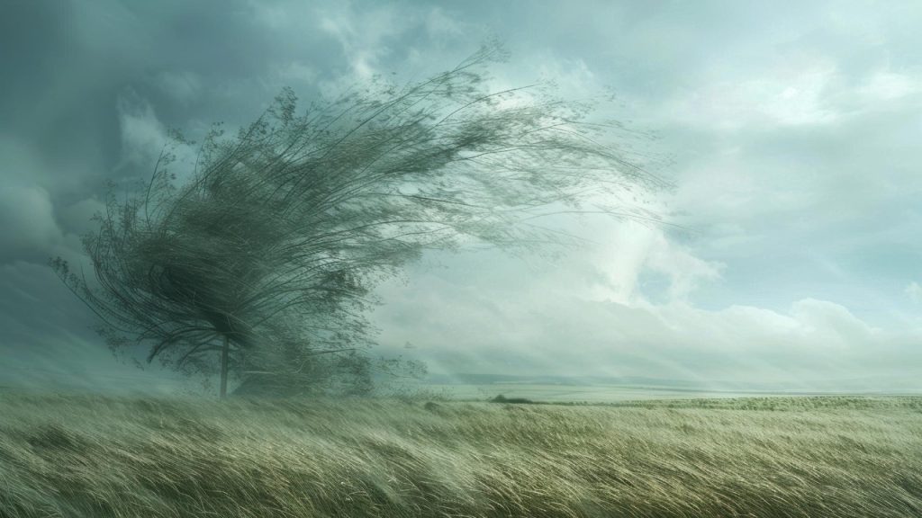
Straight-Line Winds Can Be as Destructive as Tornadoes
A lot of damage in these events comes from wind that never forms a funnel. Straight-line winds push out from storms and can hit speeds that rival weaker tornadoes.
You’ll see trees snapped, power lines down, and structures damaged. The difference is these winds hit a wider area. If you’re in timber or near older trees, that risk goes up. It’s easy to focus on tornado warnings and overlook severe thunderstorm warnings, but those wind events can do serious harm on their own.
Nightfall Makes Everything More Dangerous
Storms don’t always wrap up when the sun goes down. In fact, some of the more dangerous situations develop after dark when the atmosphere stays unstable.
At night, you lose visibility. You can’t see structure in the clouds or spot rotation. Most people are also less alert, which slows response time. If warnings are issued overnight, you’re relying on alerts to wake you up and get you moving. That’s why having multiple ways to receive warnings matters more than ever when storms carry into the evening hours.
Flooding Becomes a Secondary Threat
Heavy rain isn’t always the headline, but it builds up over time. When storms track over the same areas, water stacks up fast.
Low spots, creeks, and rural roads can flood before you realize what’s happening. If you’re driving, that’s where people get into trouble. It doesn’t take deep water to move a vehicle. Out in the field, saturated ground can also make travel difficult or unsafe. It’s not the first thing you think about in severe weather, but it’s part of the bigger picture.
You Need to Pay Attention Before the Warning Hits
Waiting for a siren or phone alert puts you behind. By the time a warning is issued, the storm is already doing something worth watching.
You’re better off tracking conditions ahead of time. Watch the sky, check radar, and know what’s moving your way. If you’re planning to be outdoors, especially in open country, you need an exit plan. Severe weather doesn’t give you much room for hesitation. Staying ahead of it is what keeps you out of trouble.Storm systems like this aren’t rare in the central states, but they demand respect every time they show up. You don’t need to panic, but you do need to stay aware and make smart calls when conditions start lining up.

Asher was raised in the woods and on the water, and it shows. He’s logged more hours behind a rifle and under a heavy pack than most men twice his age.