Winter Storm Watch Issued as Heavy Snow Expected Across Multiple States
Late April usually brings thoughts of warmer days, but a stubborn system is reminding many that winter can linger. The National Weather Service has put out watches and warnings for parts of the Rockies and northern Plains, where heavy snow could pile up quickly in higher elevations and some lower areas too. If you live in or plan to travel through these regions, paying close attention to updates makes sense right now. Conditions can shift fast with wind and dropping temperatures adding to the challenges.
Stay flexible with your plans over the next couple of days. Forecasters expect several inches of accumulation in spots, with the potential for more in mountainous terrain. This kind of late-season event catches people off guard after milder stretches, so checking road reports and having supplies ready helps avoid trouble.
What the Watches and Warnings Mean for Your Area
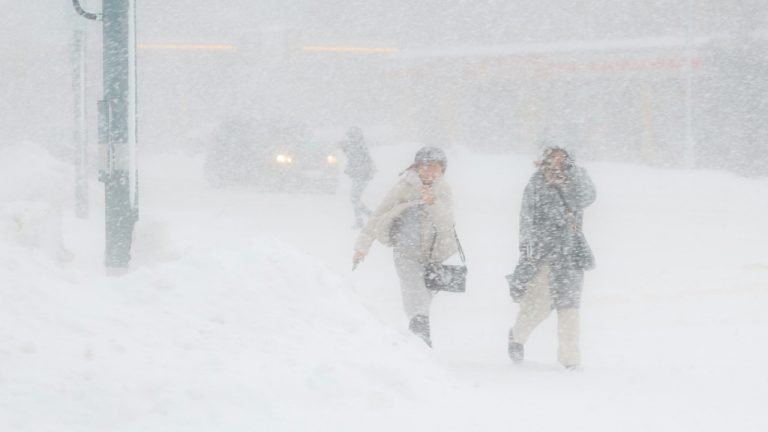
The National Weather Service issues these alerts when heavy snow and strong winds look likely enough to disrupt travel and daily routines. In affected zones across states like Colorado, Montana, and Wyoming, you could see several inches of snow, especially at higher elevations where totals might reach a foot or more in some spots. Lower areas might get a mix or lighter amounts, but blowing snow can still reduce visibility sharply.
Take time to review the specific timing for your location. Winds gusting up to 45 miles per hour or higher will create drifting and make driving hazardous. If you need to head out, clear extra time from your schedule and consider whether the trip can wait. Local offices provide detailed maps and updates that show exactly where the heaviest impacts line up.
How Much Snow Could Fall and Where
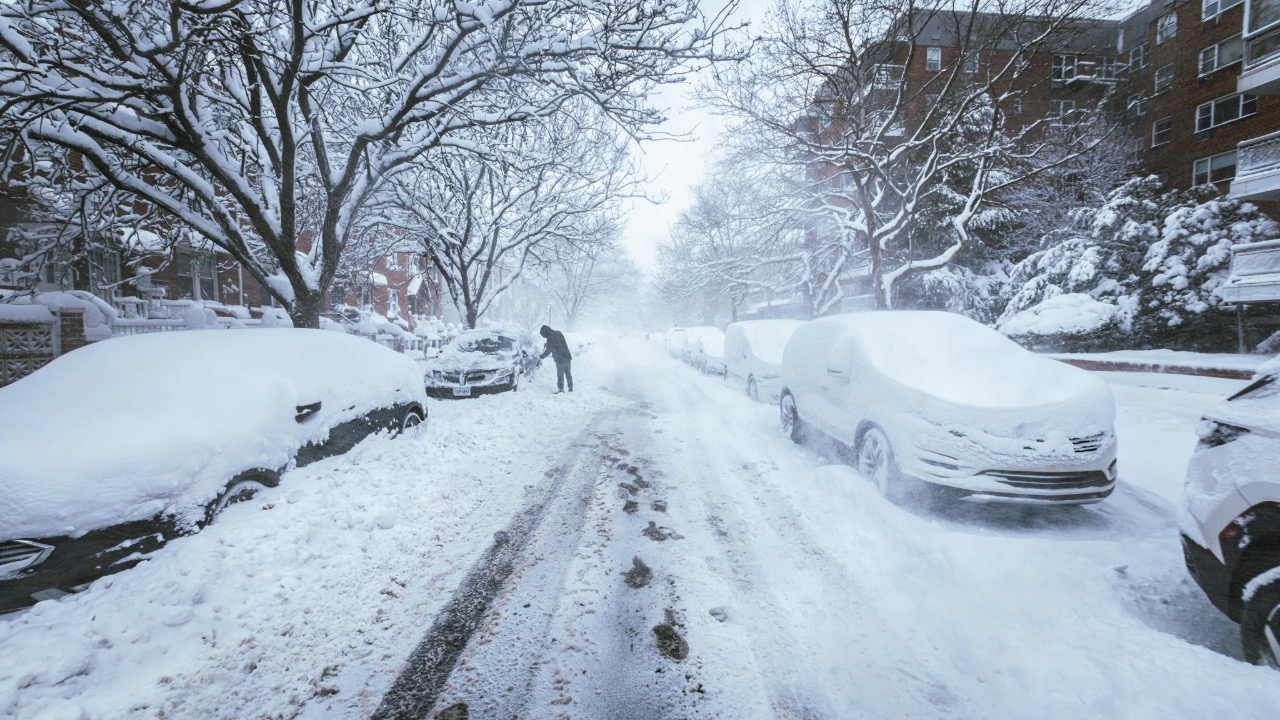
Expect the most significant accumulations in the mountains and northern sections of the impacted states. Some forecasts point to 6 to 20 inches possible in favored spots over the next day or two, with the system moving through and leaving behind colder air. Plains areas nearby might see lesser amounts or a period of mixed precipitation before it transitions.
Track the progress hour by hour if you live near the edges of the watch area. Elevation plays a big role here—higher terrain picks up more while valleys stay lighter. This variability means your neighbor a few miles away could experience something quite different, so local sources give the clearest picture.
Preparing Your Home and Vehicle
Get ahead of the storm by checking your vehicle’s battery, tires, and wiper fluid. A full tank of gas and an emergency kit with blankets, water, and snacks can make a big difference if you end up stuck. At home, make sure flashlights have fresh batteries and consider a backup way to stay warm if power lines take a hit from heavy wet snow or wind.
Stock up on easy-to-prepare food and any medications you need. Pipes can freeze when temperatures drop, so a drip of water from faucets sometimes prevents issues. These steps feel routine but pay off when the weather turns quickly this time of year.
Travel Advice During the Storm
If you must drive, go slower than usual and increase following distance. Watch for black ice on bridges and overpasses, and avoid sudden stops. Many areas advise against travel during the peak hours of heaviest snow and wind. Public transit or remote work options might serve you better until things ease.
Airports in the region often see delays or cancellations when snow moves in. Check with your airline early and build in extra time at the gate. For longer road trips, apps and state transportation sites update conditions in real time and flag closures before you reach them.
Impacts on Daily Life and Safety
Power outages become more likely when snow loads branches or wind affects lines. Have a plan for staying safe without electricity, including carbon monoxide safety if you use generators. Schools and businesses in harder-hit spots may adjust schedules, so confirm before heading out with kids or employees.
Stay informed through official channels rather than relying on social media alone. The National Weather Service and local emergency management share reliable details as the storm evolves. Taking these precautions keeps the disruption manageable even when the calendar says spring.
What Comes After the Snow Stops
Once the system passes, focus on clearing walkways and driveways safely. Wet snow can be heavy, so lift with your legs and take breaks to avoid strain. Roads may remain slick for a while as temperatures stay low, so give plows space and drive cautiously.
Warmer air will eventually return, but this event serves as a reminder to keep winter gear accessible a bit longer. Monitor forecasts for any follow-up systems, though most models suggest a shift toward milder patterns soon after.

Asher was raised in the woods and on the water, and it shows. He’s logged more hours behind a rifle and under a heavy pack than most men twice his age.