Powerful 2026 Typhoon Heads Toward U.S. Pacific Territories
You don’t have to live in the Pacific to understand what’s coming. When a strong typhoon starts lining up with U.S. island territories, it gets serious in a hurry. These storms build fast, carry a lot of water, and don’t give you much room for error once they’re close.
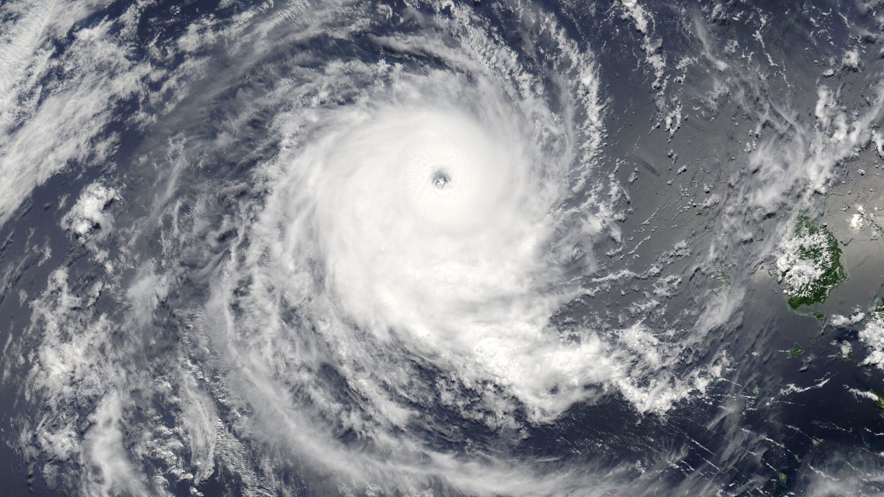
Right now, forecasters are tracking a powerful 2026 system pushing toward parts of Micronesia and U.S.-held islands in the western Pacific. The track can still shift, but the pattern is familiar—warm water, low wind shear, and a storm with room to grow. If you’ve spent any time watching these systems, you know what that combination can do.
Warm Ocean Water Is Fueling Rapid Strength
You’re looking at ocean temperatures well above average in the western Pacific, and that’s the kind of setup storms feed on. Warm water acts like high-octane fuel, allowing a typhoon to gain strength quickly.
That’s why these storms can go from manageable to dangerous in a short window. When conditions stay favorable—low wind shear and steady moisture—you can see rapid intensification. That’s the kind of change that catches people off guard. What starts as a strong storm can turn into something much more serious before it reaches land.
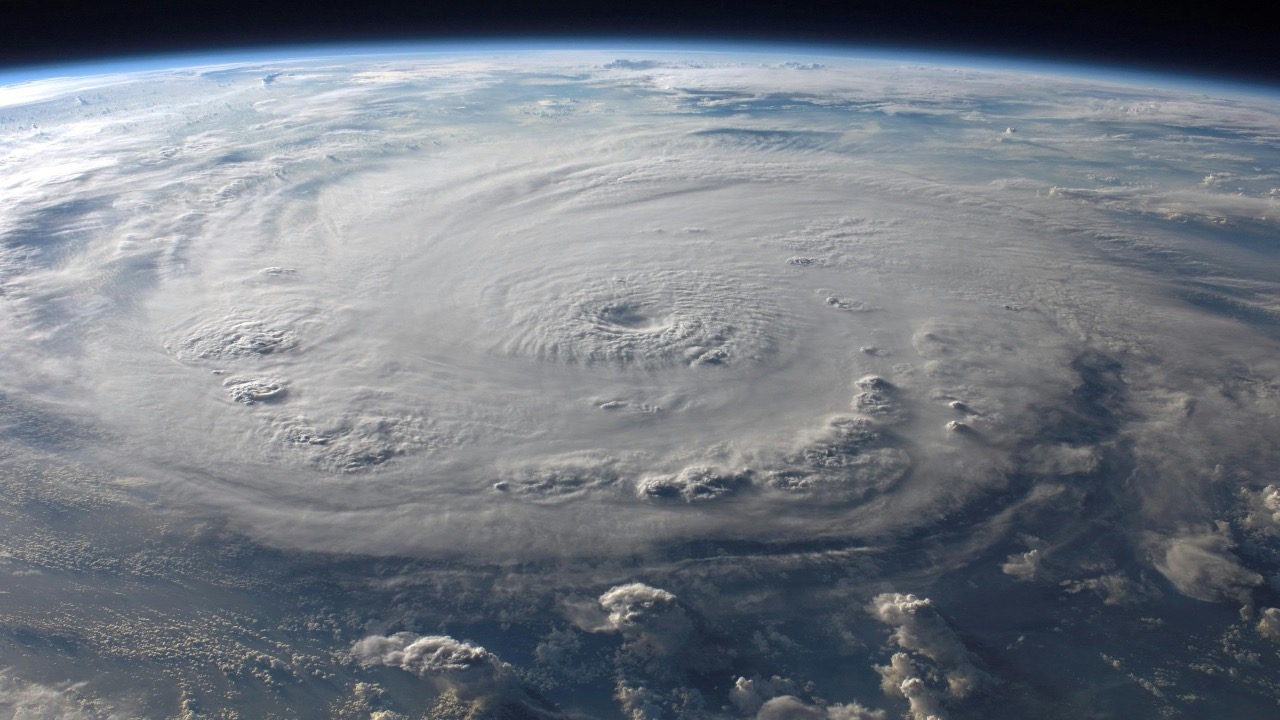
Forecast Tracks Still Leave Room for Change
You might see a projected path, but it’s not set in stone. Typhoons are known for shifting, especially several days out. A small change in steering winds can move the core of the storm miles in either direction.
That matters when you’re talking about island territories. There’s less room to absorb a direct hit. Even a slight shift can mean the difference between heavy weather and the full force of the eyewall. If you’re watching this system, you don’t lock in on one track—you watch the trend and stay ready for adjustments.
U.S. Pacific Territories Face Unique Risks
Places like Guam and the Northern Mariana Islands sit right in the path of many western Pacific storms. You’re dealing with limited landmass, exposure on all sides, and infrastructure that can be pushed hard by wind and water.
Storm surge becomes a major concern. Strong winds are dangerous, but rising water can do more lasting damage. Low-lying areas flood quickly, and evacuation options aren’t always as straightforward as they are on the mainland. When a typhoon lines up here, preparation has to happen early.
Wind Damage Builds Fast and Hits Hard
With a strong typhoon, wind isn’t steady—it comes in violent bursts that tear at anything exposed. Roofs, power lines, and trees take the brunt of it.
You’ll often see structural damage before the storm even peaks. Once sustained winds climb, repairs are off the table until it passes. Flying debris becomes a real hazard, especially in areas with older construction. Even well-built structures can take a hit when gusts keep coming hour after hour.
Heavy Rainfall Can Outlast the Storm Itself
Rain is often what lingers after the wind moves through. These systems carry deep moisture, and when they slow down or interact with terrain, rainfall totals can stack up fast.
That leads to flash flooding and landslides, especially in hilly or mountainous areas. Ground that’s already saturated can’t handle much more. Even after the center moves away, runoff keeps moving downhill. You don’t measure impact only by wind speed—you look at how much water the storm leaves behind.
Emergency Preparation Windows Are Short
You don’t always get a long lead time with these storms. Once watches turn into warnings, things move quickly. Supplies, fuel, and safe shelter become priorities all at once.
On islands, resources can run thin faster than expected. Shipping delays and limited storage mean you prepare early or risk going without. If you wait until the last minute, you’re competing with everyone else trying to do the same thing. The people who handle these storms best are the ones who start getting ready before it feels urgent.
Power and Communication Outages Are Likely
Strong typhoons tend to knock out power grids and communication lines. It doesn’t take much—downed poles, damaged substations, or saltwater intrusion can shut things down.
Once power goes, recovery isn’t immediate. Crews have to wait for safe conditions before repairs begin. That leaves communities relying on backup systems, if they have them. Communication can also get spotty, which makes it harder to get updates or call for help. Planning for outages isn’t optional in storms like this—it’s expected.
Recovery Can Take Longer Than Expected
After the storm passes, the real work starts. Clearing debris, restoring power, and rebuilding damaged structures takes time, especially on islands where outside help may take days to arrive.
You’re also dealing with supply chain delays. Materials, fuel, and equipment don’t always show up right away. That stretches recovery out longer than most people expect. Even moderate damage can disrupt daily life for weeks. It’s a reminder that the storm itself is only part of the problem—the aftermath carries its own weight.
When you watch a typhoon build in the Pacific, you learn to respect how quickly things can change. This 2026 system is shaping up in a way that deserves attention. If you’re anywhere near its potential path, you don’t wait for certainty—you prepare for impact and adjust as the track tightens.

Asher was raised in the woods and on the water, and it shows. He’s logged more hours behind a rifle and under a heavy pack than most men twice his age.