America’s most dangerous volcano is expected to erupt, scientists warn, with potential to devastate nearby towns in minutes
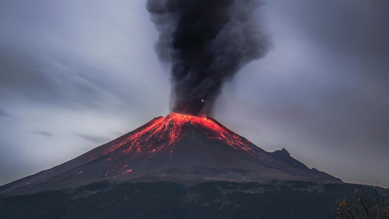
Scientists are sounding the alarm about Mount Rainier, long ranked as the most dangerous volcano in the United States, after new assessments suggest its next major eruption could send torrents of mud and debris racing into nearby communities within minutes. The mountain’s icy flanks and proximity to densely populated valleys mean a single event could endanger tens of thousands of people with little time to escape.
Researchers now warn that a large collapse on Rainier’s western side could unleash a wall of mud up to 1,000 feet high, capable of wiping out entire towns, highways, and industrial zones in the lowlands south of Seattle and Tacoma. The risk is not theoretical, scientists say, but rooted in the volcano’s history of catastrophic landslides and lahars that have already reshaped the region.
What happened
Recent hazard modeling of Mount Rainier has focused on the volcano’s west flank, where unstable rock and thick ice sit above river valleys that funnel directly into populated areas. In one scenario, a massive flank collapse triggers a lahar, a fast-moving slurry of water, ash, and boulders, that could reach nearby towns in less than an hour and some communities in a matter of minutes. In the worst case, the initial surge could tower to roughly 1,000 feet, according to new modelingthat examines how such a collapse would behave.
Mount Rainier is already categorized as the most hazardous volcano in the country because of the number of people who live on its flanks and in its downstream valleys. Federal and regional assessments cited by a recent risk analysis estimate that at least 60,000 residents could be directly in the path of lahars that follow the Puyallup, Carbon, and Nisqually river systems. These valleys now host suburbs, warehouses, and transportation corridors that did not exist during the volcano’s last large events.
The new warnings build on decades of geologic work that has traced ancient lahar deposits as far as the Puget Sound lowlands. Those deposits show that Rainier has produced multiple large collapses even without a dramatic explosive eruption. In some past events, entire sides of the volcano failed, sending thick blankets of mud and rock across what are now housing developments and industrial parks. That history underpins current emergency planning and the decision to treat Rainier as an active, high-priority threat.
Scientists emphasize that there is no sign of an imminent eruption in the next days or weeks. Instead, they describe a volcano that is slowly deforming, venting heat, and interacting with its heavy ice cover in ways that can weaken its slopes over time. This combination of internal activity and external erosion is what makes a sudden collapse plausible, even if gas emissions or seismic signals remain relatively modest until shortly before the event.
Why it matters
The central concern is speed. Lahars generated on Rainier’s steep flanks can accelerate to highway speeds as they funnel into narrow valleys, leaving residents in downstream towns with only minutes to react. Emergency managers in communities such as Orting, Puyallup, and Sumner have long warned that sirens and text alerts might offer only a brief window for people to reach higher ground before the flow arrives. Unlike lava, which typically moves slowly enough to avoid on foot, a lahar can behave more like a sudden flood loaded with concrete-thick debris.
Volcanologists often rank Mount Rainier among the world’s most dangerous volcanoes, not because it is the most explosive, but because it combines large ice volumes, unstable rock, and dense development on its flanks. Global assessments that compare volcanoes like Vesuvius, Merapi, and Rainier highlight that risk is a function of exposure as much as raw power. As one overview of high-risk volcanoes explains, a moderate eruption near a city can be far deadlier than a much larger event in a remote area.
In the case of Rainier, the hazard is amplified by how the region has grown. The Puyallup River valley now contains residential neighborhoods, schools, and major logistics hubs that serve the broader Seattle metropolitan area. A large lahar could not only threaten lives but also sever Interstate 5, rail lines, and port facilities that handle a significant share of the Pacific Northwest’s freight. The economic impact of losing these corridors for weeks or months would ripple far beyond the immediate blast zone.
There is also a long-term environmental cost. Lahars can bury farmland under meters of sediment, reroute rivers, and destroy salmon habitat that tribes and local communities depend on. Past flows from Rainier have left thick deposits that still shape the modern river channels. A new large event would likely require extensive dredging, levee reconstruction, and habitat restoration, all while communities struggle with displacement and rebuilding.
Public health concerns extend beyond the initial disaster. Fine ash, even in modest quantities, can infiltrate ventilation systems, scratch lungs, and disrupt power infrastructure. Water supplies could be contaminated by sediment and volcanic chemicals. Hospitals in Tacoma and surrounding cities would face a surge of trauma cases at the same time that transportation bottlenecks complicate patient transfers and supply deliveries.
All of this plays into a broader conversation about how the United States prepares for low-probability but high-consequence natural disasters. The country has extensive experience with hurricanes and wildfires, yet large volcanic events remain outside the lived memory of most residents in the lower 48 states. Officials who work on Rainier’s hazard plans argue that complacency is a risk in itself, particularly in communities where the volcano is visible on the horizon yet rarely discussed as a present danger.
What to watch next
Scientists are watching a set of indicators that, taken together, can signal changes in Rainier’s behavior. These include small earthquakes beneath the volcano, subtle ground deformation measured by GPS and satellite radar, and shifts in the temperature or chemistry of hot springs and fumaroles near the summit. Any sustained increase in these signs would likely trigger more frequent updates from the U.S. Geological Survey and regional emergency agencies.
Residents in at-risk valleys will increasingly see preparedness efforts woven into daily life. Many school districts already conduct lahar drills that teach students to move quickly to predesignated high ground, often along ridgelines or elevated roads. City planners are mapping pedestrian evacuation routes, installing signage, and working to ensure that new developments consider vertical evacuation options such as reinforced upper floors in public buildings.
Local governments are also refining alert systems that can push warnings through multiple channels at once. Sirens, wireless emergency alerts, and automated phone calls are designed to trigger simultaneously when monitoring networks detect the signature of a large lahar. Officials stress that people cannot rely on seeing or hearing the flow itself; in some valleys, the first visible sign could be a wall of debris already too close for a safe escape.
At the policy level, funding decisions will shape how quickly monitoring and preparedness can scale. Expanded seismic networks, additional GPS stations, and continuous satellite analysis all require sustained investment. Advocates for volcano monitoring argue that the cost of these systems is small compared with the potential losses from a single large lahar that strikes without adequate warning.
Residents and businesses in the region are likely to face more pointed conversations about land use. Some hazard maps place existing neighborhoods squarely within lahar inundation zones. While mass relocation is politically and economically difficult, officials may push for stricter building codes, insurance requirements, and disclosure rules for property sales in high-risk areas. The goal is not to empty the valleys, but to ensure that people who live and work there understand the stakes and have realistic plans.
For now, scientists describe Mount Rainier as a restless but not yet escalating system. The volcano’s past shows that large collapses and lahars can occur with limited warning, yet the same history also suggests long quiet intervals between major events. That tension between urgency and uncertainty will define how the region prepares. The more communities treat Rainier’s hazard as a planning problem rather than a distant threat, the better the odds that when the mountain does shift, people in its shadow will have the minutes they need.

Leo’s been tracking game and tuning gear since he could stand upright. He’s sharp, driven, and knows how to keep things running when conditions turn.