Storm systems that turn dangerous faster than forecasts suggest
Some of the most dangerous storms are not the ones that loom as monsters on a five-day outlook, but those that intensify in a matter of hours, outpacing both models and public expectations. From squall line tornadoes to rapidly strengthening hurricanes and derechos racing across the map, these systems can turn from routine to life threatening faster than forecasts suggest, leaving communities with little time to act.
Forecasters are racing to keep up, blending new artificial intelligence tools with traditional physics-based models and a growing network of sensors. Even so, the atmosphere still finds ways to surprise, and the gap between a watch on a phone and a wall of wind outside the window remains one of modern meteorology’s hardest problems.
The limits of current forecasting
Modern weather prediction rests on a dense web of satellites, radar, aircraft measurements and surface stations feeding into global and regional models. Agencies such as NOAA and its partners run those models on supercomputers to simulate how temperature, moisture and pressure will evolve over time. For large-scale patterns, such as the track of a winter storm across a continent, that system performs far better than it did a generation ago.
Yet even with better data and more computing power, accurately predicting storm behavior remains a significant challenge. Technical guidance notes that forecasters still struggle when storms hinge on small-scale triggers, such as a narrow boundary between air masses or subtle wind shifts, that models do not always capture well. The organization of the national forecast enterprise reflects that tension, with national centers handling broad patterns and local offices trying to interpret how those patterns will play out over a single county or coastline.
Research summaries on storm behavior describe how numerical models ingest vast amounts of atmospheric data to simulate future conditions, yet even small errors can compound into large differences in storm intensity or timing. A guided study on storms notes that “Accurately predicting storm behavior remains a significant challenge” and that “Weather forecasting” depends on approximations that can miss rapid shifts when the atmosphere is near a tipping point. That gap is where surprise intensification lives.
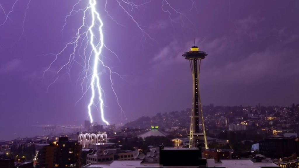
Thunderstorms that escalate in minutes
Thunderstorms are among the fastest evolving systems, and they often provide the clearest examples of danger ramping up faster than forecasts. National guidance explains that Tornadoes are the most dangerous and damaging aspect of severe thunderstorms, and that Wind speeds of tornadoes can reach to near 300 m per hour in the most violent events. That level of intensity can develop from a storm that looked ordinary on radar only an hour earlier.
Education material on thunderstorm structure notes that There are also three main types of thunderstorms. Single cell storms contain one updraft and one downdraft, while multicell and supercell storms feature more complex circulations that can support large hail and tornadoes. Even within those categories, small changes in wind shear or moisture can flip a storm from garden variety to severe in a short window, which is why short-fuse warnings often arrive with only minutes of lead time.
Researchers point out that not all tornadoes come from classic rotating supercells. Guidance on tornado types describes Non supercell tornadoes and other vortices that can form along boundaries or within squall lines, and notes that Non, Supercell Tornadoes And related phenomena account for a significant share of events that tend to be EF2 or less. These can spin up quickly along a line of storms that forecasters expected to produce mainly straight-line wind, which complicates both messaging and preparedness.
Squall line tornadoes and “sneaky” threats
One of the clearest examples of storms turning dangerous faster than forecasts suggest comes from squall lines. Reporting on severe weather has highlighted how Aug coverage described Squall line tornadoes as sneaky, dangerous and difficult to forecast. In these systems, a long line of thunderstorms forms along a front, often with a well-advertised risk of damaging wind. Embedded within that line, however, small kinks and surges can spin up tornadoes with little warning.
Forecasters explain that radar signatures in squall lines are harder to interpret than in isolated supercells. The circulation that produces a tornado may be shallow or obscured by heavy rain, and the line itself can move quickly. As a result, a community might hear about a generic risk of “strong storms” in the morning, only to face a brief but intense tornado in the afternoon that was not apparent on earlier guidance.
Efforts to improve this picture include specialized research on line dynamics and new warning concepts. The Threats In Motion project, described as TIM, is a warning generation approach that would enable the NWS to advance severe thunderstorm and tornado warnings from the current county-based system to polygons that move forward with a storm. By letting warnings follow the actual motion of a squall line, TIM aims to give people in the path more precise and timely alerts, especially when hazards such as embedded tornadoes evolve rapidly.
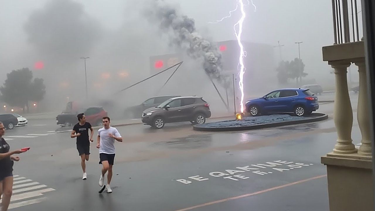
Derechos and straight-line wind surprises
Another class of fast-changing storms involves derechos, which are sprawling complexes of thunderstorms that produce destructive straight-line wind. A derecho is described as a widespread, long-lived, straight-line wind storm that is associated with a band of rapidly moving showers or thunderstorms and is often classified as a mesoscale convective system. The term itself comes from Spanish, and that Spanish root reflects the “straight” nature of the winds compared with the twisting winds of a tornado.
Local hazard guidance notes that Typically, derecho producing storm systems move at speeds of 50 m or greater, and a few have been clocked at 70 m. Such rapid forward motion means the most intense part of the storm can move from one town to the next in minutes, and the same guidance warns that Such storms can appear on very short notice. Forecast discussions might highlight a risk of severe storms along a front, but the exact corridor where a derecho will consolidate and race ahead often becomes clear only shortly before impact.
These events can produce hurricane-force gusts over hundreds of miles, yet they often emerge from what initially looks like a routine line of thunderstorms. For power grids, rail networks and highways, that difference between “scattered storms” and a high-speed derecho can mean the difference between minor delays and widespread damage.
Rapidly intensifying hurricanes
While tornadoes and squall lines change in minutes, tropical cyclones pose a different kind of forecasting challenge: rapid intensification. Coverage of major storms has explored Why some hurricanes grow into massive storms and why they are hard to predict, using Hurricane Laura as a case study. That storm strengthened quickly over warm water before landfall, highlighting how small shifts in ocean heat content, wind shear and internal storm structure can produce a sharp jump in wind speed.
The Saffir Simpson Hurricane Wind Scale, which classifies hurricanes by sustained wind, describes the damage potential for each category. Official guidance notes that Many shallowly rooted trees will be snapped or uprooted and block numerous roads in certain categories, and that Near total power loss is expected with outages that can last from several days to weeks when winds reach the highest levels. When a storm intensifies faster than expected, communities can suddenly find themselves facing those “Many” and “Near” scenarios without the full window of preparation that a slower strengthening curve would provide.
Scientists studying hurricane growth point to structural changes within the storm, such as the formation of a tight inner eyewall, and to environmental factors like ocean eddies rich in heat. However, capturing those details in real time remains difficult. A study highlighted by NCAR noted that rapid intensification may occur in two primary modes and concluded that the two modes may represent opposite ends of a spectrum, with many cases of rapid intensification falling in between. That spectrum view helps explain why forecast models sometimes miss the timing or magnitude of a sudden ramp-up in winds.
Extreme winter storms and cold waves
Cold season storms also have a reputation for surprising both forecasters and the public. A detailed look at extreme winter events framed forecasting as so complex that Jan commentary joked Maybe forecasting should be a sport in the Winter Olympics. The same analysis distinguished between a cold wave, where temperatures plunge sharply, and a broader winter storm that mixes snow, ice and wind, and noted that small shifts in storm track can mean the difference between flurries and a crippling blizzard.
Forecasters describe how moisture transport from distant oceans, subtle temperature gradients and jet stream kinks can all interact in ways that models struggle to resolve. Consequently, a storm that looked like a moderate snow event two days out can evolve into a high-impact system with heavy snow, damaging wind and coastal flooding once the atmosphere “locks in” a particular configuration. That late shift can leave road crews, utilities and schools scrambling to adjust plans.
National centers share updates through weather news briefings, outlooks and social media, but the public often remembers the initial forecast more than the later refinements. When a winter storm intensifies faster than early guidance suggested, that memory gap can feed frustration and a sense that the storm “came out of nowhere” even when forecasters had been flagging increasing risk.
When forecasts fail at sea and in space
Rapidly changing storms do not only threaten land. Maritime safety reports emphasize that Weather forecasting has definitely improved over the years, but storms can still develop faster than predicted or change course unexpectedly, leaving vessels in dangerous conditions without adequate time to reach safety. For cargo ships, fishing boats and naval vessels, a line of thunderstorms that intensifies into a severe squall or a low-pressure system that deepens quickly can mean heavy seas, reduced visibility and navigation hazards that were not fully apparent in earlier outlooks.
Beyond the atmosphere, researchers are also concerned about extreme solar storms that can disrupt power grids and communications. A detailed warning described how Agencies including NASA, the National Aeronautics and Space Administration, and NOAA, the National Oceanic and Atmospheric Admin, are monitoring coronal mass ejections and related geomagnetic storms that could trigger widespread power outages and damage infrastructure. The same analysis noted that warning time for an Earth-directed CME is short, about two to four days, and that recovery from severe damage could take months.
While geomagnetic storms are not “weather” in the traditional sense, the pattern is familiar: a low-probability but high-impact event with limited lead time and complex physics. As with fast-changing thunderstorms, the challenge lies in translating technical risk assessments into decisions about grid operations, satellite maneuvers and internet backbone resilience before the window closes.
AI, faster models and the race for lead time
To keep up with storms that intensify quickly, researchers are turning to artificial intelligence and machine learning. A recent project described how a new system generated storm predictions in only 30 to 40 seconds using one graphical processing unit, a speed that is at least a factor of 10 faster than traditional approaches. That work, linked through Storm Prediction Gets, shows how AI can rapidly emulate complex physics-based models, freeing forecasters to run more scenarios and update guidance more often.
Leo’s been tracking game and tuning gear since he could stand upright. He’s sharp, driven, and knows how to keep things running when conditions turn.