Pennsylvania winter storm forecast calls for significant late-weekend impact
A large winter storm is tracking toward Pennsylvania late Sunday into Monday, and meteorologists have been tuning forecast models as the system organizes. Most of the state is under at least a winter storm warning, with eastern portions—including the Philadelphia region—facing the brunt of heavy snow and strong winds.
Timing will matter: light snow or mixed precipitation may begin Sunday morning, with transition to steadier snow by late afternoon or evening. Road conditions will change quickly as temperatures hover near or below freezing, leading to potentially icy surfaces before the heavier bands arrive.
Snowfall Looks Heavy in Pockets
Forecast guidance points to widespread snow, but how much will fall depends on where you are. In south-central Pennsylvania, officials are estimating 4 to 8 inches, with higher amounts—8 to 12 inches—possible closer to Lancaster, Lebanon, and toward Philadelphia as the storm peaks Sunday night into Monday.
Further east and in urban centers like Philly, updated guidance suggests snowfall totals could reach over a foot, with localized amounts up toward 16–22 inches in some areas. Strong winds will cause drifting and reduce visibility, compounding the expected impact. These totals could make Monday morning’s commute especially slow or dangerous.
Blizzard and Wind Threats
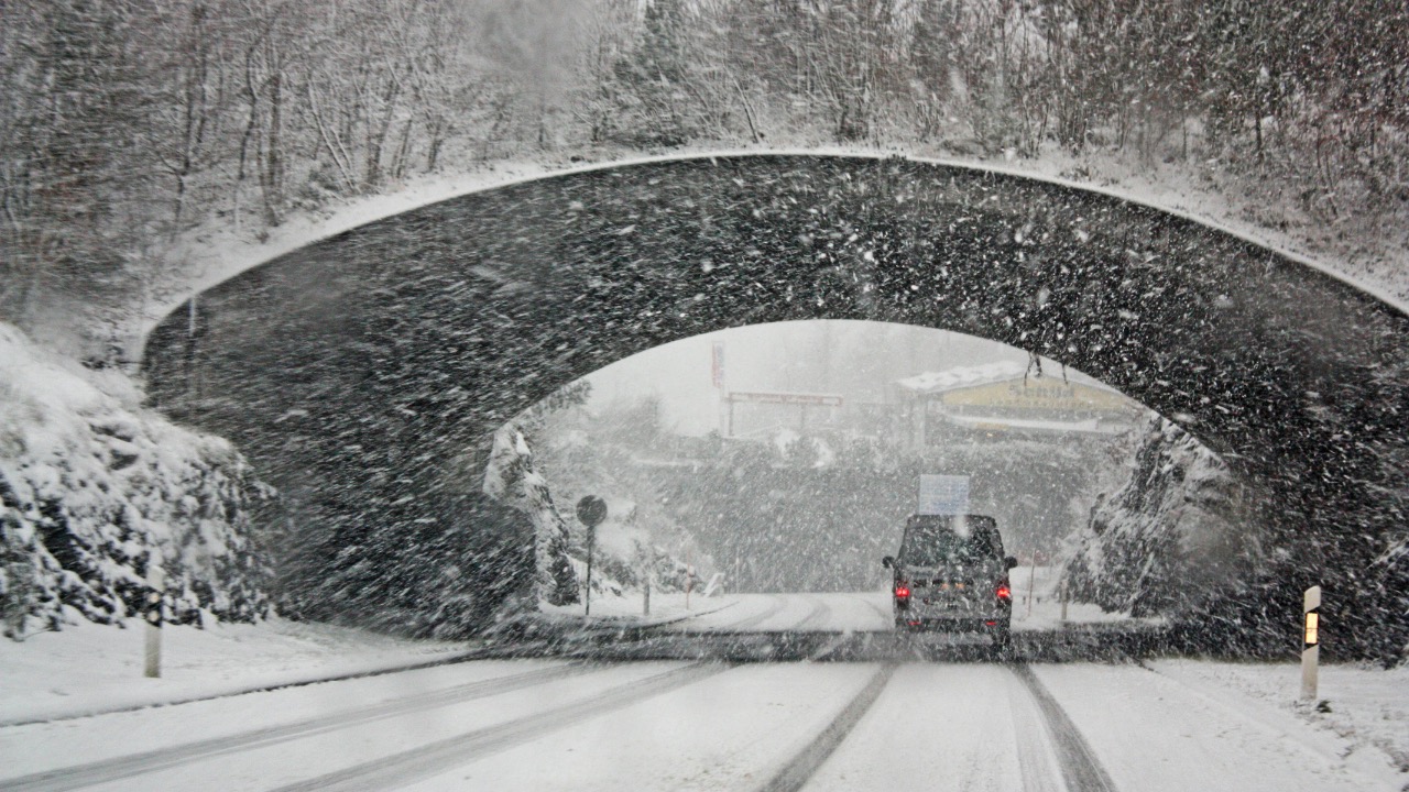
Along the I-95 corridor and coastal region, conditions are pushing toward blizzard criteria: heavy snow plus sustained winds capable of blowing snow into whiteout conditions. Blizzard warnings are already in effect for parts of New Jersey and Delaware that border eastern Pennsylvania, and snow rates of 1–3 inches per hour are possible overnight Sunday into Monday.
Even if your area doesn’t see blizzard conditions, stronger gusts will make travel tricky. Gusty winds can spread snow quickly across untreated roads, create drifts, and limit visibility along major highways and rural roads alike. Be ready for slow, inconsistent driving conditions.
Travel and Road Impacts Expected
Pennsylvania transportation agencies are clear that travel will deteriorate quickly once snow begins to accumulate. Roads that are wet or slushy Sunday afternoon will likely be snow-covered by evening, and the increasing winds will reduce visibility at times.
Officials recommend avoiding non-essential travel from Sunday evening into Monday morning if possible. Snowplows and crews will be working, but heavy snow rates and drifting may outpace initial clearing efforts. Allow extra time if you must venture out, and stay updated with real-time road conditions.
Power and Community Preparedness
With significant accumulating snow and wind gusts expected, downed limbs and power lines are a real risk. Utilities in southeastern Pennsylvania and the state’s eastern tier will be on alert, and outages could occur, especially if wet snow accrues on tree branches before temperatures fall.
Now’s the time to check your emergency supplies: flashlights, batteries, blankets, and enough food and water for a couple of days. Charge devices, ensure generators (if you have them) are serviced, and look out for neighbors who may need help preparing. Solid preparation cuts stress when the snow starts.
Western and Northern PA Will See Snow Too
The storm won’t just impact the east. Winter storm warnings extend into south-central and Susquehanna Valley counties, where several inches of snow and strong winds are on the way. Snow may fall more moderately here, but 4–8 inches isn’t out of reach for many central and northern locations.
Western Pennsylvania will see lighter accumulations overall, but periods of steady snow can still make Saturday night and Monday wet and slippery. In the Laurel Highlands and higher elevations, totals could trend higher than surrounding valleys, and blowing snow will affect travel.

Asher was raised in the woods and on the water, and it shows. He’s logged more hours behind a rifle and under a heavy pack than most men twice his age.